


With a monster high pressure system hovering over the mainland, unfortunately there isn’t much chance of natural snow in the forecast this week 😦 High pressure systems block snow bearing cold fronts and push them south-east into the Tasman Sea, where they typically continue on their journey before crashing into New Zealand (great for our Kiwi friends, but not us).
The good news is high pressure systems typically bring sunny days and crisp, cold nights. If it’s cold enough (and it should be), rest assured the snow guns WILL be cracking.
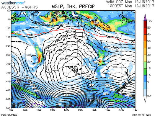

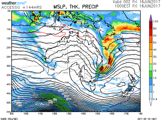
Analysis of the BOM and Weatherzone charts tonight (10 June) shows the continued dominance of the high pressure system at least until Wednesday, after which the charts get a bit weird. Some of the charts show the presence of an east coast low (ECL), moving from north to south down the east Australian seaboard – and it’s packing a lot of moisture, and not the frozen kind either 😦 Hopefully the models sort themselves out by the end of the week, and that ECL buggers off into the Tasman Sea.
Let’s pray to Ullr those pesky high pressure systems start to weaken soon 😦

it is a good blog.
LikeLike
Thank you
LikeLike